Aruba AirWave VisualRF Features
Overview of Aruba AirWave VisualRF
AirWave VisualRF gives you an accurate view of your entire network without ever leaving your desk.
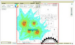
AirWave™ VisualRF™ automatically generates a map of your RF environment and the underlying wired topology, showing you what your network looks like — in real time. VisualRF builds this map using RF measurements gathered from your active wireless access points and controllers, without requiring you to buy a costly, separate location appliance. You can see exactly who is on your network, where they are, and how the network is performing.
Armed with the RF coverage and location data provided by VisualRF, you can solve problems faster, improve service quality for users, and make better decisions about your network.
What’s Unique About VisualRF?
- Simple setup process that doesn’t require site surveys or additional dedicated sensors, exciters, or location servers
- Support for the full network lifecycle, from planning, to installation, to troubleshooting
- Free, stand-alone planning tool delivers identical planning capabilities in an online or offline environment
- Combination of methods to provide the most accurate information: dynamic RF sampling and a predictive model based on site and infrastructure characteristics for areas where RF sampling isn’t available
- Generally achieves resolution below 10 meters without additional tuning activities
- Real-time location tracking for users and devices
- Open API provides for a cost-effective way to utilize location data to a variety of location-based business applications
Aruba AirWave VisualRF Specifications
SIMPLE SETUP PROCESS
• No need for additional dedicated sensors, exciters or location servers
• Imports existing building floor plans and maps from third-party tools
• Supports DWG, DWF and DFX CAD file formats as well as common image file formats
• Batch upload tool can import hundreds of floor plans at one time
• Automatically discovers and polls devices via AirWave Management Platform™
• Automatically tracks any device that associates with the network, including laptop computers, PDAs, wireless VoIP phones, scanner guns and many Wi-Fi asset tags
EFFECTIVE SITE PLANNING — DEPLOY YOUR NETWORK RIGHT THE FIRST TIME
• Determines the right quantity and placement of APs, controllers and switches based on your coverage goals
• Helps you plan deployments that utilize the dozens of AP vendors supported by AirWave Management Platform
• Incorporates switches and wiring closets into network design
• Automatically generates bill of material reports in HTML and Microsoft® Word formats to simplify the quote and physical deployment process
VISUALRF PLAN: FREE STANDALONE PLANNING TOOL
• Runs on Windows-based laptops and workstations
• Uses the same RF planning and visualization algorithms as the integrated VisualRF module
• Allows plans made offline to be imported into the integrated VisualRF module (and vice versa)
EFFICIENT TROUBLESHOOTING
• Different visual overlays display heatmaps of expected signal quality, expected 802.11 data rates, upstream relationships between APs and wiring closets and the number of radios that can serve a voice client at every point on a floor plan
• Automatically recalculates coverage maps and device locations as it receives real-time data from the wireless LAN infrastructure
• Performs what-if analysis for proactive coverage planning by simulating the failure of a number of deployed radios
• Google Earth™ mapping service integration shows device locations and mesh network links for outdoor deployments
OPEN ARCHITECTURE
• XML API enables cost-effective integration of valuable location data with other applications
ACCURATE LOCATION DATA
• Allows quick location of users and wireless devices for troubleshooting, planning and asset tracking
• Generally achieves resolution below 10 meters — horizontally and vertically — without requiring special sensors or site surveys
• Plays back a user’s location history over the past day to aid in troubleshooting and recovery of lost devices
• Last known location of each tracked device is stored indefinitely to help find lost or stolen devices
BETTER SECURITY
• View locations of rogue APs discovered by AirWave RAPIDS for faster investigation and threat removal
• Plan the proper locations for dedicated Wi-Fi sensors such as Aruba air monitors to ensure complete coverage of your organization’s airspace


